|
WILMA
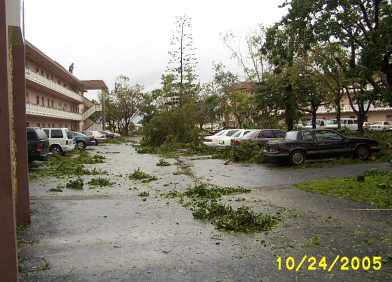
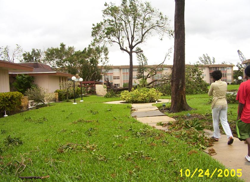
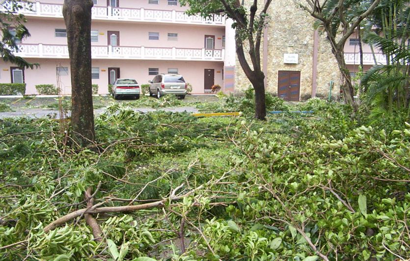
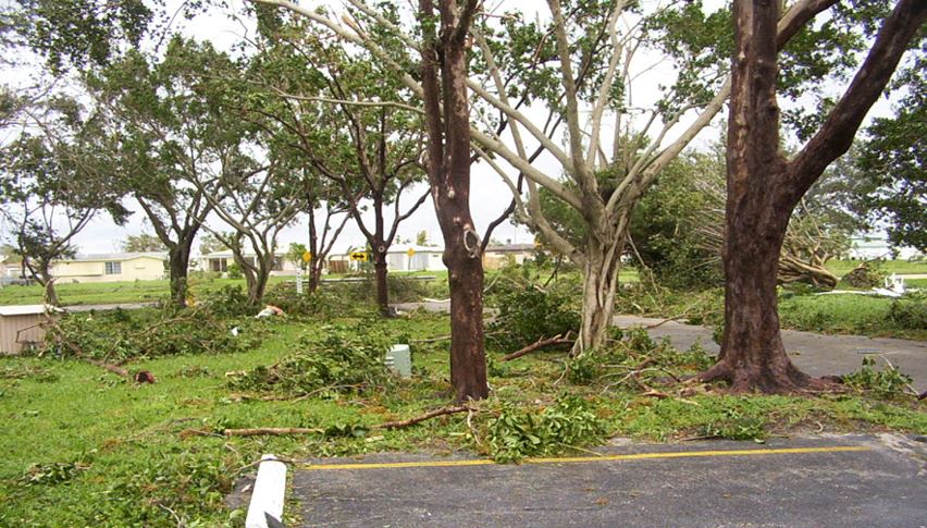
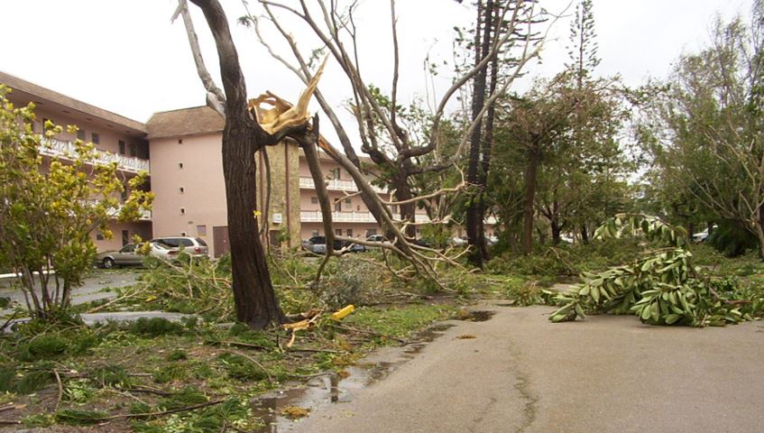
HAWAIIAN GARDENS The October 24, 2005 Selon des témoignages de canadiens sur place Wilma a frappé ici vers 05:00 le matin pour se terminer vers 14:00 et le soir venu un merveilleux coucher de soleil |
 |
 |
 |
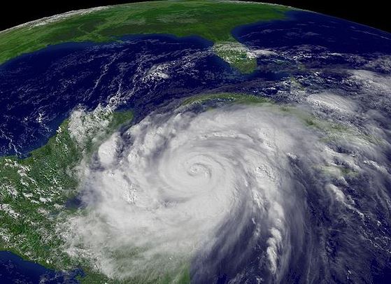
| L'ouragan Wilma est la 22e tempête tropicale, dépassant la saison cyclonique 1933 et le 12e ouragan enregistré dans le bassin de l'océan Atlantique en 2005. C'est le 4e ouragan de catégorie 5 de la saison cyclonique 2005, après Emily, Katrina et Rita, laissant définitivement loin le record de deux ouragans de catégorie 5 en 1960 et 1961. C'est la première utilisation de la lettre W, et par conséquent, du nom Wilma. Wilma est l'ouragan le plus intense jamais observé sur le bassin cyclonique de l'Océan Atlantique Nord, avec une pression barométrique centrale de 882 millibars (18 octobre 2005 à 8:00 EDT). Le record précédent avait été atteint par l'ouragan Gilbert en 1988 (888 millibars). ********************* Hurricane Wilma is the 22nd tropical storm, exceeding the cyclone season 1933 and the 12th hurricane recorded in the basin of the Atlantic Ocean in 2005. It is the 4th hurricane category 5 of the 2005 cyclone season, after Emily, Katrina and Rita, leaving permanently far the record of two hurricanes of category 5 in 1960 and 1961. This is the first use of the letter W, and therefore, the name Wilma. Wilma is the most intense hurricane ever observed on the cyclonic basin of the North Atlantic Ocean, with a central barometric pressure of 882 millibars (October 18, 2005 at 8:00 a.m. EDT). The previous record had been hit by Hurricane Gilbert in 1988 (888 millibars). |
 |
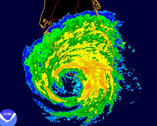
| Image des précipitations de Wilma par le radar météorologique du sud de la Floride Image of precipitations of Wilma by the weather radar of the south of Florida |
 |
 |
 |
|
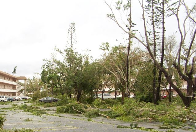
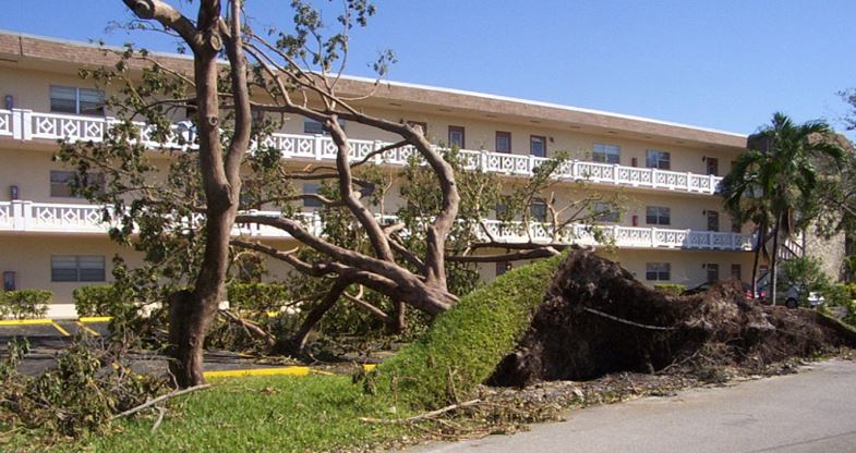
Passage en Floride
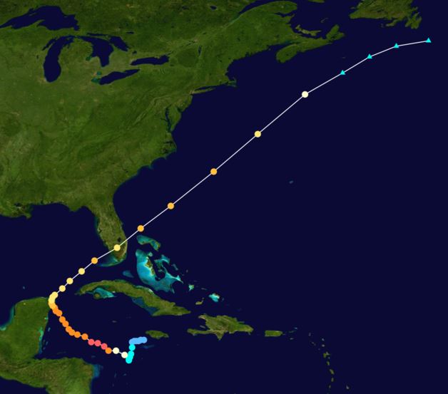
Un puissant courant-jet qui se déplaçait au-dessus des États-Unis entraîna Wilma vers le nord-est, soit vers le sud de la Floride. Bien que le cisaillement du vent fût important dans le golfe du Mexique, le cyclone s'intensifia, atteignant la catégorie 3. Au nord-ouest de l'ouragan, un vigoureux front froid associé au courant-jet commença à pousser le cyclone, ce qui le fit accélérer jusqu'à 45 km/h. Le 24 octobre 2005, vers 10:30 UTC, Wilma toucha terre près de Cape Romano en Floride, avec des vents soutenus à 195 km/h (120 mi/h). Après avoir traversé la Floride pendant 4,5 heures, l'œil de Wilma émergea dans l'océan Atlantique au sud-est de Jupiter (Floride), vers 15:00 UTC, entouré de vents soutenus à 175 km/h (catégorie 2). ************** A powerful jet stream which was moving above the United States led Wilma toward the north-east, either to the south of Florida. Although the wind shear was important in the Gulf of Mexico, the hurricane was intensified, reaching category 3. To the north-west of the hurricane, a vigorous cold front associated with the current-jet began to push the cyclone, which fit the accelerate up to 45 km/h. On October 24th, 2005, around 10:30 UTC, Wilma touched ground close to Romano Cape in Florida, with winds supported to 195 km/h (120 mi/h). After having crossed Florida during 4.5 hours, the eye of Wilma emerged in the Atlantic Ocean in the Jupiter south-east (Florida), around 15:00 UTC, surrounded by winds supported to 175 km/h (category 2). |
 |
 |
 |